robota.ai

Industrial Scale AI Engines

Point cloud labeling

Aervision’s A.I. automatically classifies aerial LiDAR point cloud to ground, vegetation, poles, powerline wires and more: a proven solution that reduces workload by 95% in real-world data.

ROBOTA.AI also does:

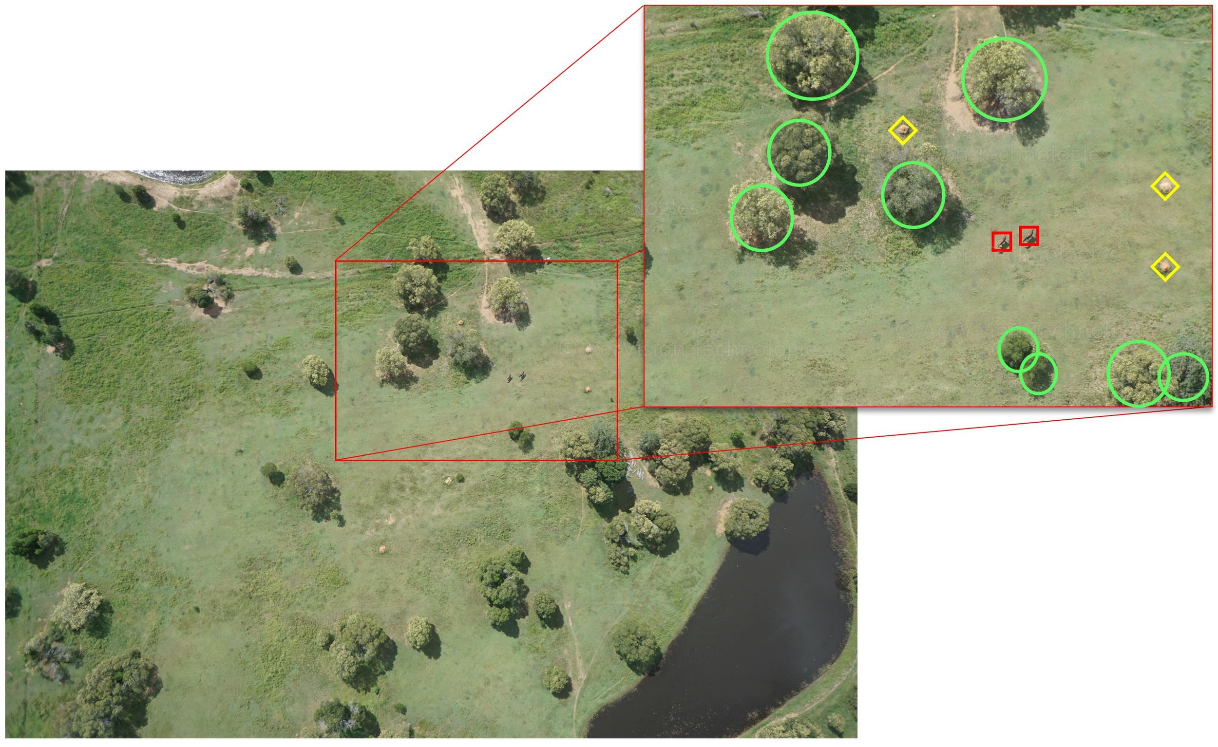
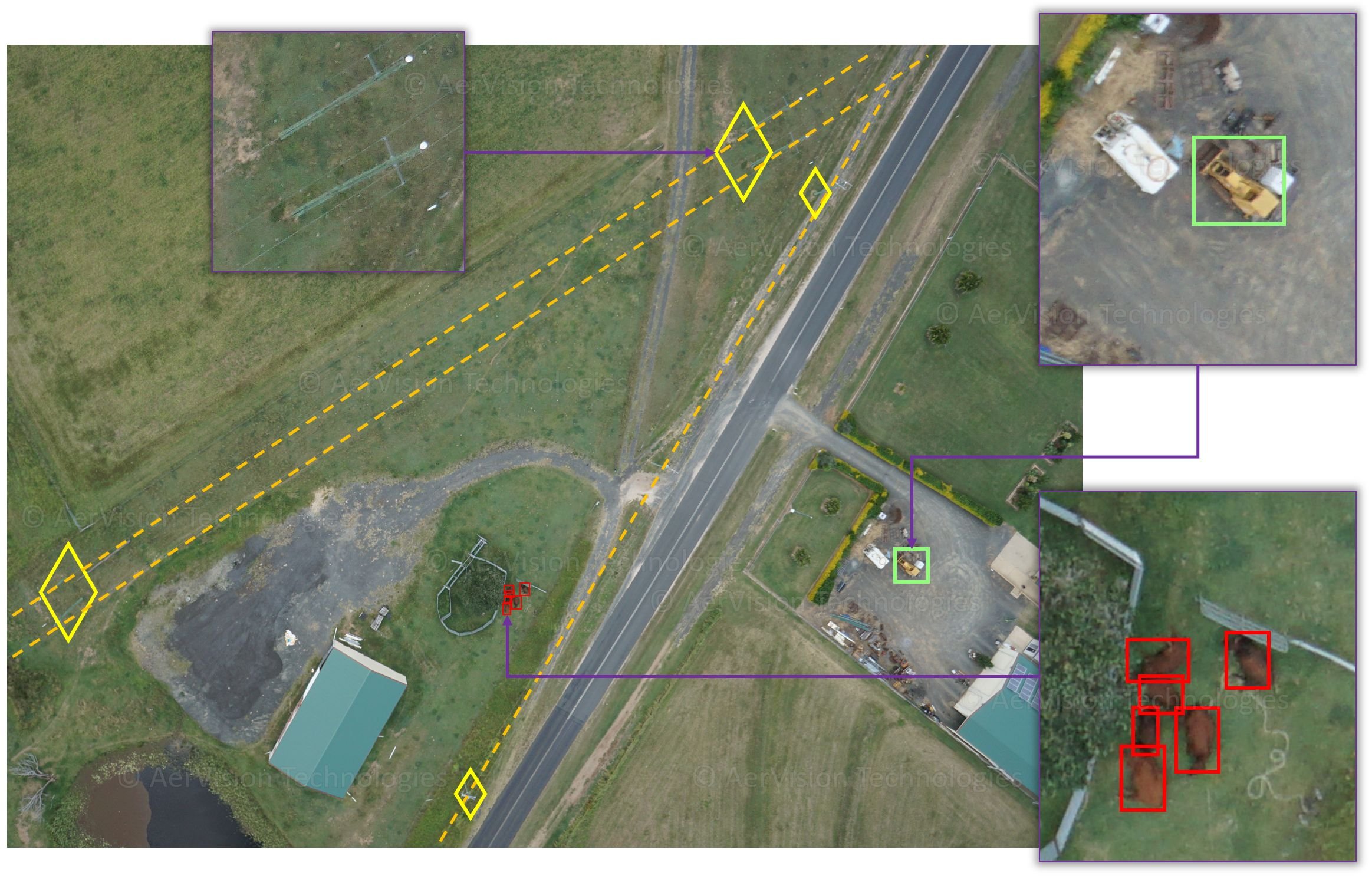
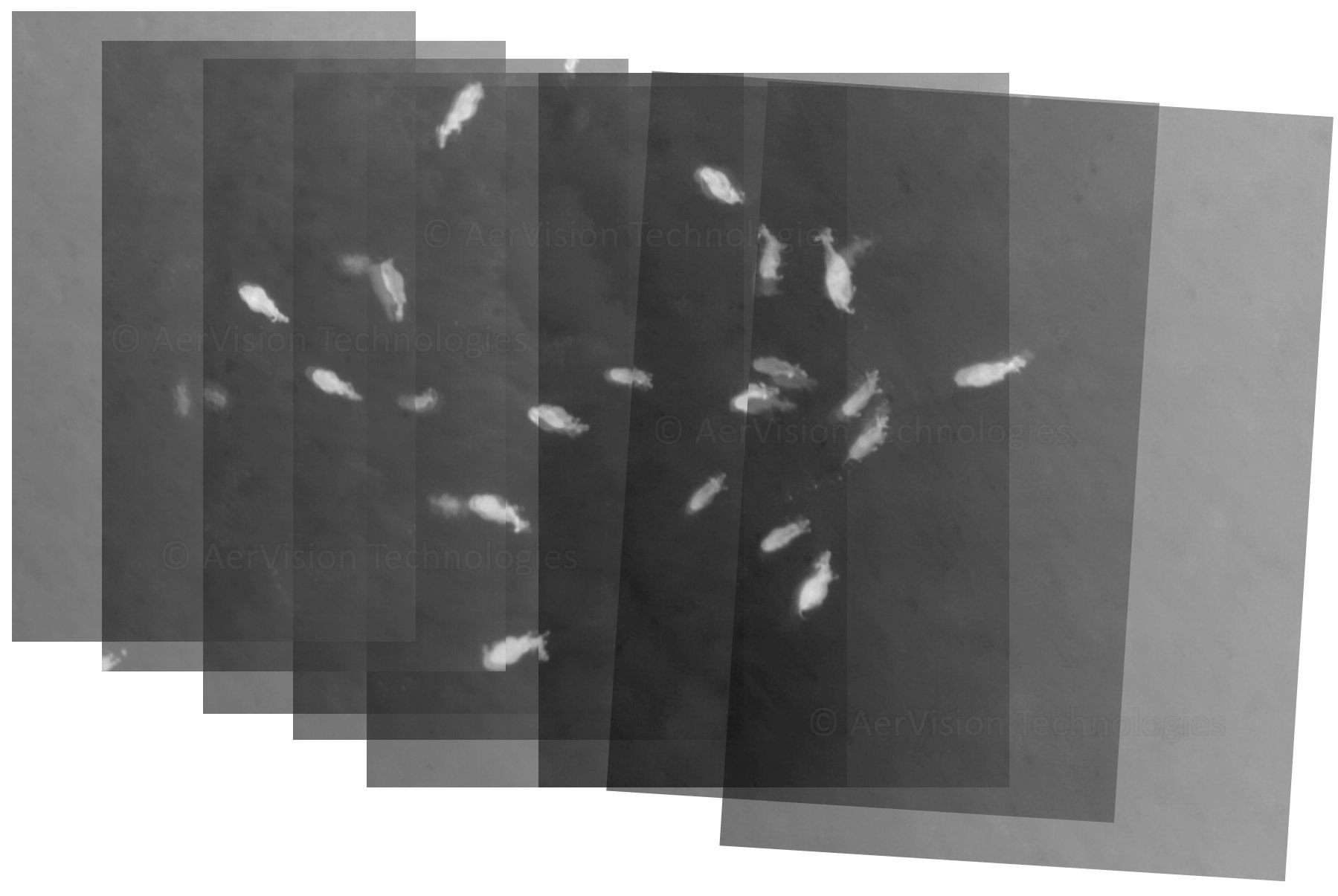
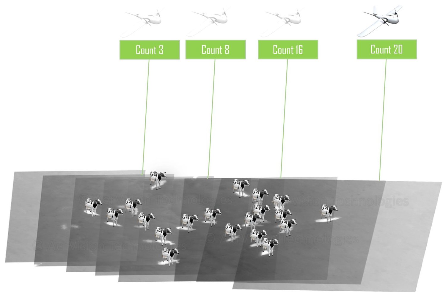
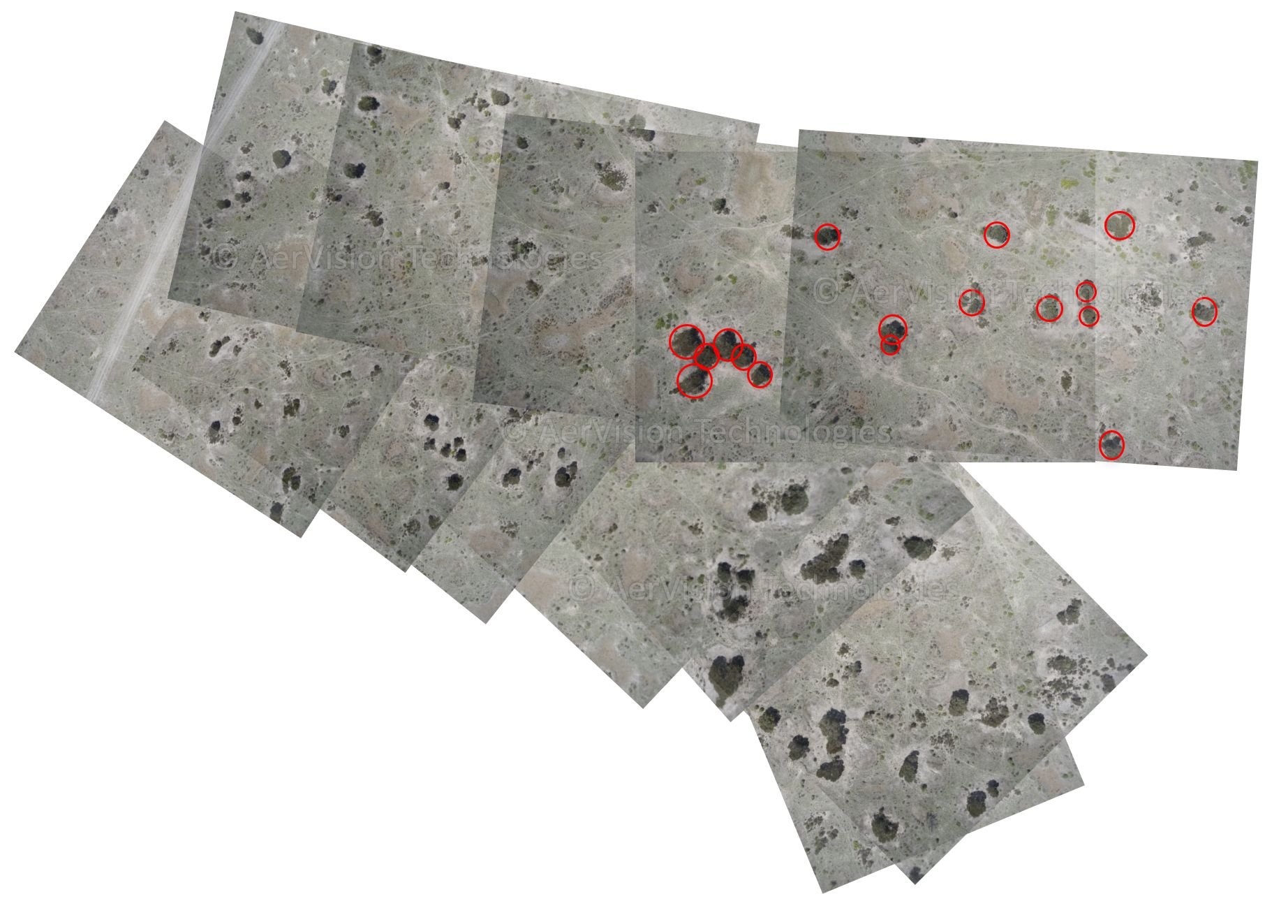
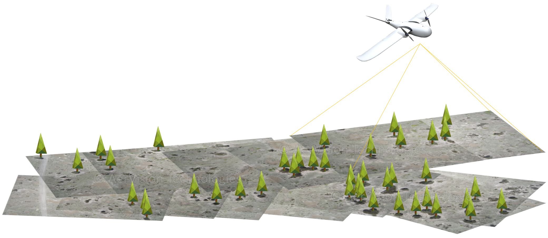
Aerial Image Labelling

Aervision’s unique machine learning based image classification has been widely used to label aerial images of various types of content. Those include trees, animals, infrastructure, water sources, fencing, power lines and many more.

Farm Survey

Cattle Counting

An example of using Aervision’s automated labeling of aerial images. An nVidia Tx2 system on-board a drone counts cattle and beams back the accurate count as it surveys a large farm.

Vegetation Survey - Tree Counting

Using Aervision’s proprietary automated labeling of aerial images, trees, vegetation and any special types of plants are detected, labelled and measured.